Mapping Experiences Project Brainstorming
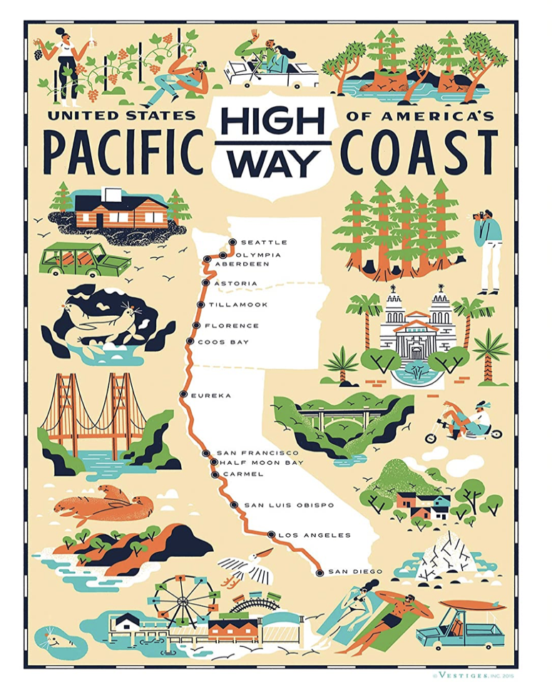
One experience I’m interested in mapping is the Pacific Coast Highway (colloquially known as Highway 1), which runs from northern California down to San Diego. I’m originally from the West Coast and remember road trips I would take with my family as a kid. It runs through the beautiful California coastline as well as the Redwood forests - a dynamic reflection of the West Coast. As for dimensions, I would aim to capture not only the major touristy destinations/cities that it runs through, but also the emotional sentiment captured by driving down these roads. I found the Edward Tufte readings particularly influential, and aiming to incorporate many of these attributes to help frame the viewer/allow them to escape from the “flatland” of a two-dimensional map. There are many online resources that can serves as data sources for my mapping idea, such as the National Geographic and Visit the USA. When researching into this topic, I found a map poster wall that captures the essence that I was going for, however it is still fairly simple in its design. If I were to pursue this project further, I would like to incorporate more nuances that would allow the viewer to gain both a micro and macro view of the work (and facilitate thinking/discussion).